EnglishΕλληνικά
Fixed-wing UAV for real-time vehicle tracking in GPS-denied environments
An undergraduate thesis focused on designing and building an autonomous fixed-wing UAV for real-time vehicle detection and tracking. The aircraft can fly complete missions on its own, follow moving targets through its onboard vision system, and continue navigating when GPS is unavailable or unreliable.
PX4 on a Pixhawk-compatible flight controller handles the aircraft's autonomous mission logic, including take-off, waypoint navigation, loitering, and landing. The vision and localization systems give the flight controller the information it needs to operate beyond a normal GPS-only workflow, while a manual RC override remains available for safety.
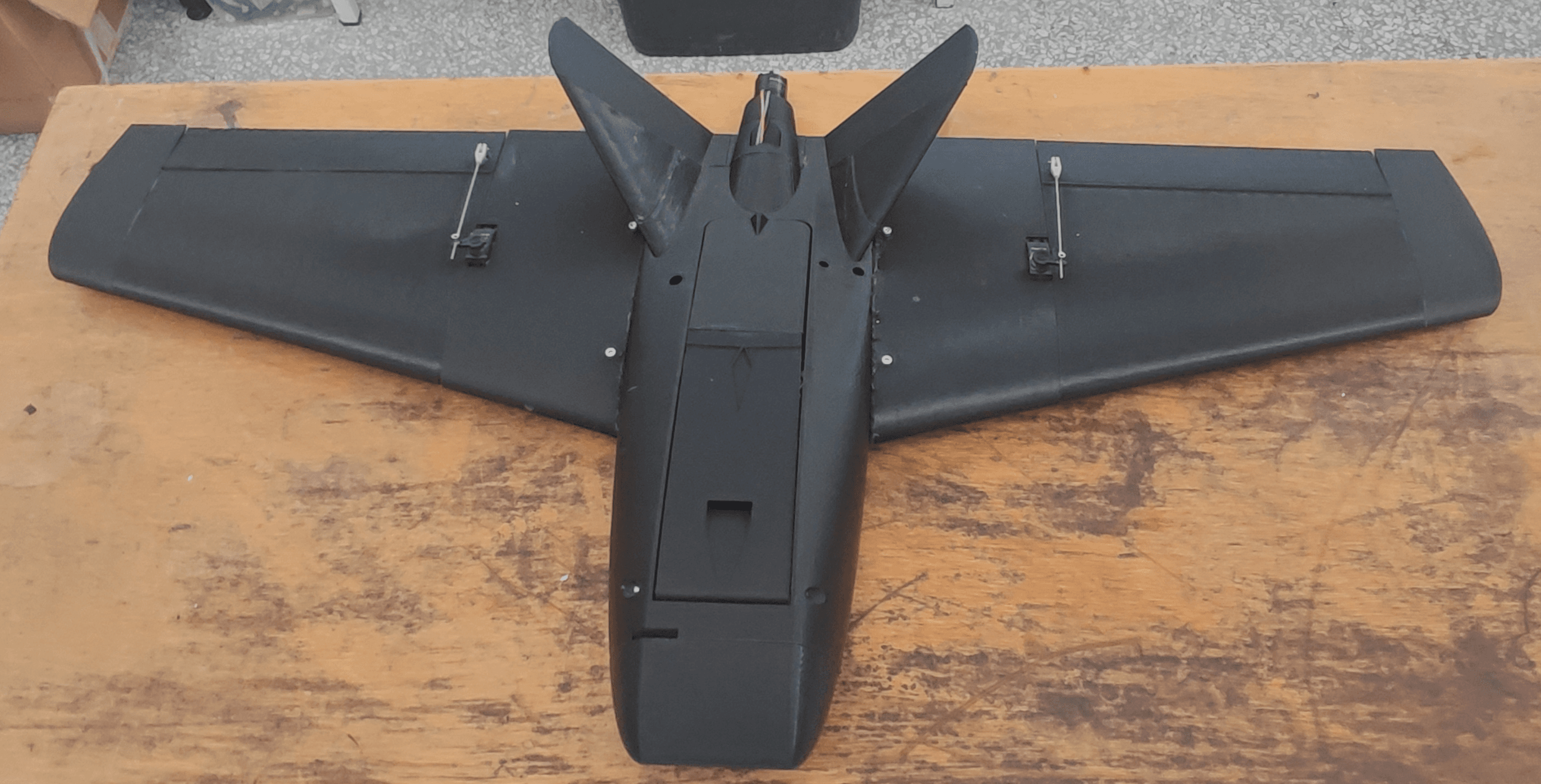
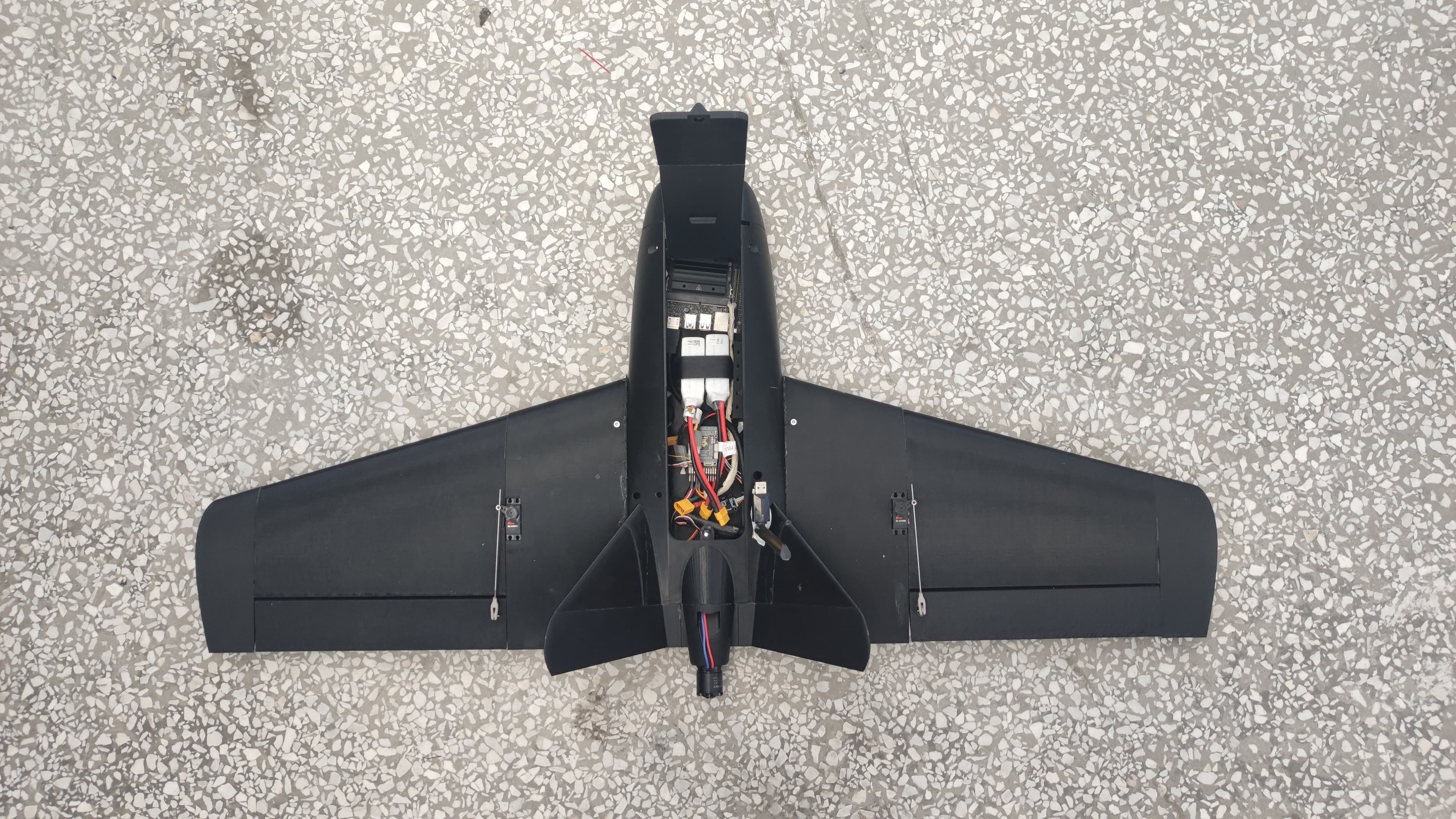
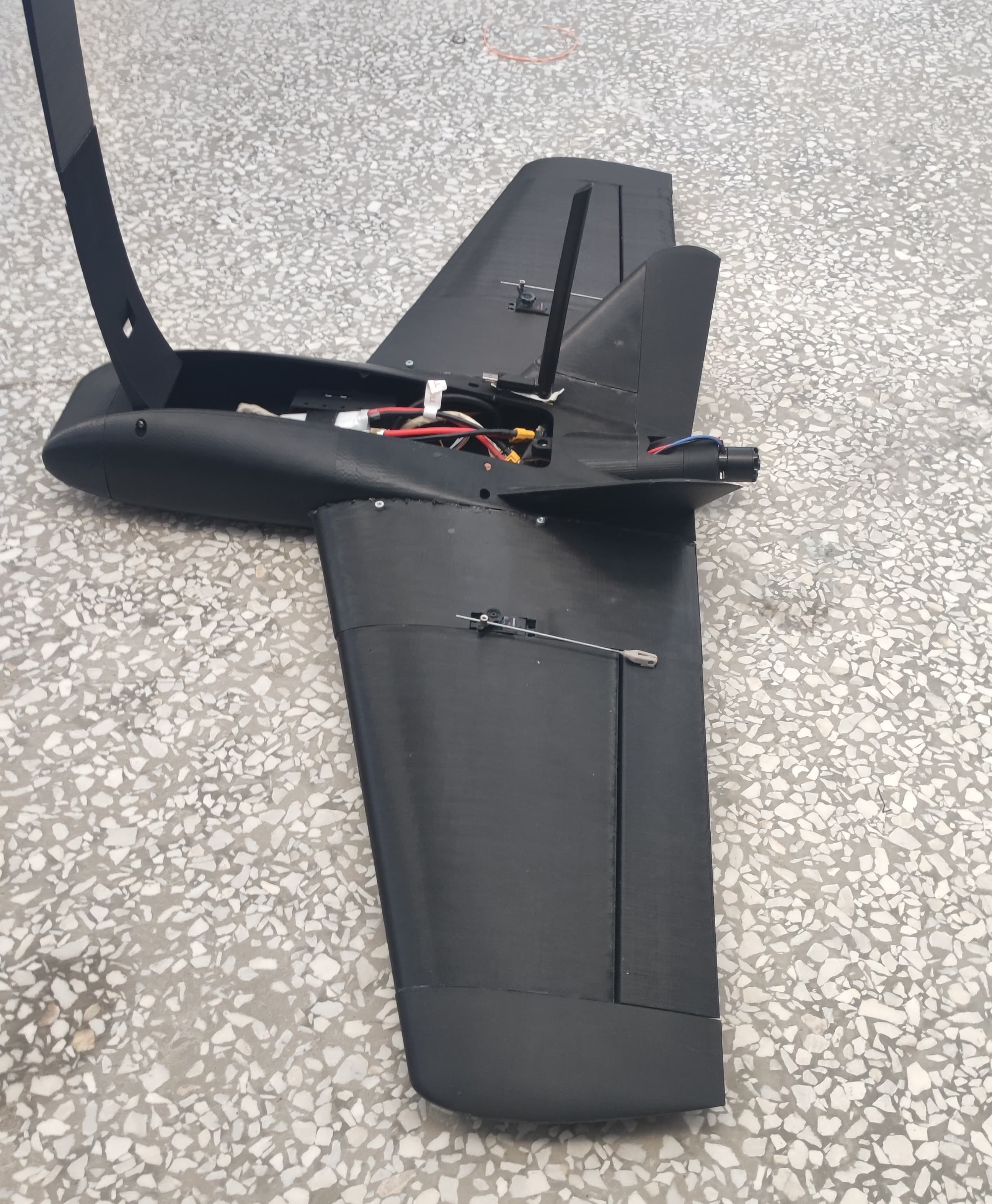
The airframe is based on a modified Titan Dynamics Slinger with a 3D-printed PETG skeleton, reinforced with PA12-CF for strength. A pusher motor provides forward propulsion. An NVIDIA Jetson Nano runs the vision pipeline, the Pixhawk runs flight control, and a Raspberry Pi relays telemetry. A custom power board keeps the propulsion and computing systems on separate LiPo batteries, with filtering to protect onboard electronics from power noise.
The onboard camera detects vehicles with YOLO11 Nano, trained on a custom aerial dataset of approximately 1,500 annotated frames collected with a DJI Phantom 4. Data augmentation—including rotations, flips, colour changes, and mosaic transforms—helps the model cope with varied viewing conditions. The model runs in TensorRT at FP16 precision, reaching 25–30 frames per second on the Jetson Nano. A Kalman-filter tracker keeps each vehicle's identity consistent from frame to frame.
When GPS is unavailable or degraded, the aircraft uses its camera to work out where it is. Live camera frames are matched against geo-referenced map tiles, whose known scale provides a real-world reference. This allows the system to estimate its position, direction, and altitude from what the camera sees. Those estimates are combined with IMU motion-sensor data to keep navigation stable between visual matches. The underlying approach is described in more detail in the Visual Localization project.
Dynamic resolution scaling adjusts camera quality according to the available computing power. When localization, detection, and tracking run together, the system can reduce resolution to maintain a responsive frame rate. The custom Rust-based RPV system provides the low-latency link between the aircraft and ground station, carrying live video, MAVLink telemetry, and manual RC override over raw 802.11.